Monday 22 May 2017 - 13:13
Story Code : 261976
FAO Introduces new tool to monitor forest diseases in Iran
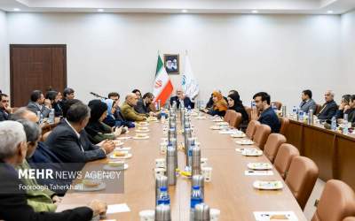
The workshop is slated for 21- 25 May in the city of Karaj, Alborz Province, some 35 km northwestern Tehran.
According to a press release published by the FAO Representation in the Islamic Republic of Iran, in his opening remarks, Fabio Grita, the FAO Representative ad interim to Iran highlighted that Collect Earth could be a very effective system for monitoring forest resources on regular basis and could also serve as platform for exchanging knowledge with the other countries that have adopted the same system.
He underscored that effective engagement of Iran in making this system operational would pave the way for strengthening the role of this country in promoting South-South Cooperation at a regional level in this specific thematic area.
�FAO is bringing to the Islamic Republic of Iran the state-of-the-art technology on forest mapping and monitoring by using geospatial information software tools�, Grita said.
Giulio Marchi, the FAO Geospatial Forestry Officer is the instructor of the workshop and he will train 30 government officers from the Ministry of Agriculture Jihad for the next four days.
The Collect Earth workshop is organized within the framework of the FAO project entitled �Assistance to Strengthening the Resilience of Zagros Forests to Oak Decline and Caspian Forests to Boxwood Blight and Development of National Forest Monitoring System in the Islamic Republic of Iran� and aims to build an effective national forest monitoring system for undertaking more accurate assessment of the impact and evolution of the dieback in the Zagros and Caspian forests.
Collect Earth is a user-friendly Free and Open Source Software, developed in FAO-Forestry, for land monitoring through the augmented visual interpretation of freely available satellite images.
The system builds on Google technologies such as Google Earth, Earth Engine and the availability of Landsat, Sentinel 2 and other very high resolution images.
The training has geared toward technical staff mostly from the Ministry of Agriculture Jahad, Department of Environment (DoE) and other relevant stakeholders.
Source: UN Information Center in Tehran (UNIC)
# Tags
