Anzali Free Zone borders line is clear on the Gilan province map. This area is about 23 kilometers on the East of Bandar Anzali.
The Caspian Sea is on the north of Free Zone. The Fatato village and Ghazian of Anzali are on the South. Anzali lagoon is on the East. Anzali-Khomam highway is on West and North West.
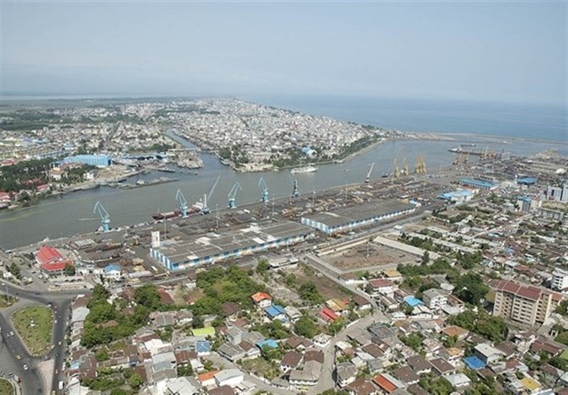
Anzali Free Zone is constituted in 2 separate sections in the west and east of Bandar Anzali; each part has its own specific potentials.
The area includes docks, shipping and ports organization and facilities, customs office, industrial city, natural territory and properties.
It also includes beautiful natural lands and properties for cultivation of summer crops, an less populated area. The easy access to beaches and recreation facilities, as well as some rice fields are among the other features of the region.
Anzali port is one of the most active harbors among the 5 Caspian Sea littoral states and is the biggest northern seaboard of Iran.